Hike Mt Greville - the best of Moogerah Peaks

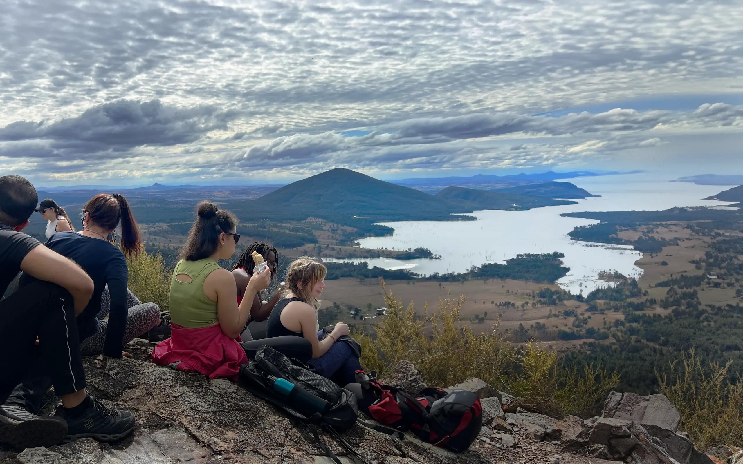
Take the Tough Route Up Waterfall Gorge for Unbeatable Lake Moogerah Vistas on this Scenic Rim Thriller
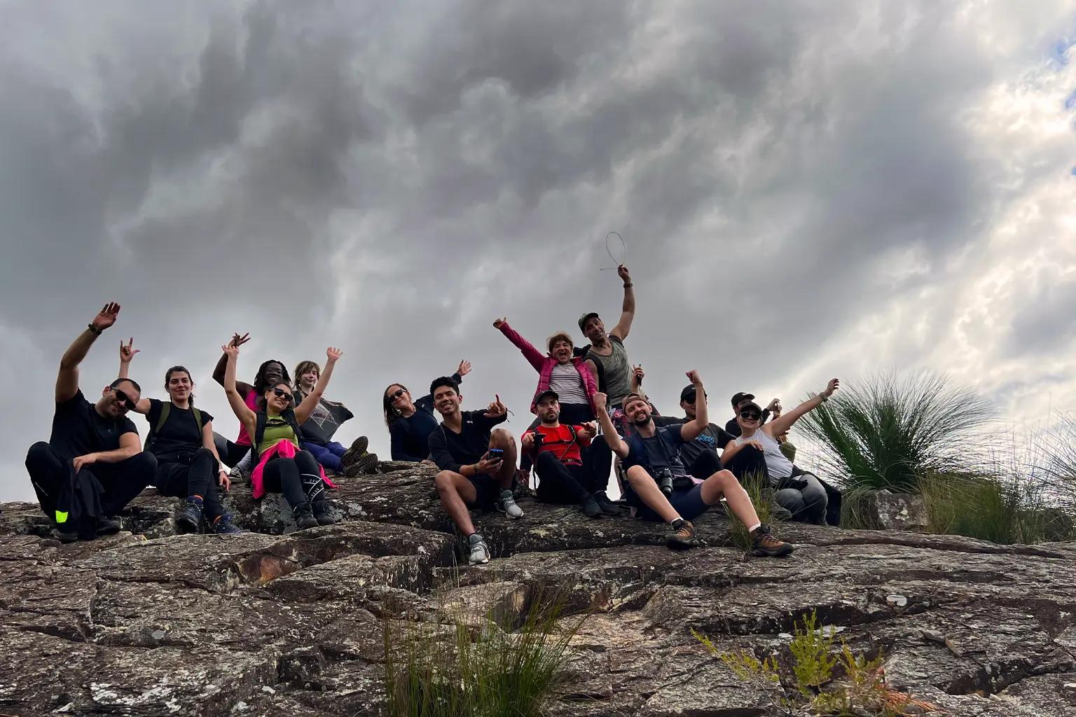
Epic Scenic Rim Peak Demanding Stamina and Scrambling Skills
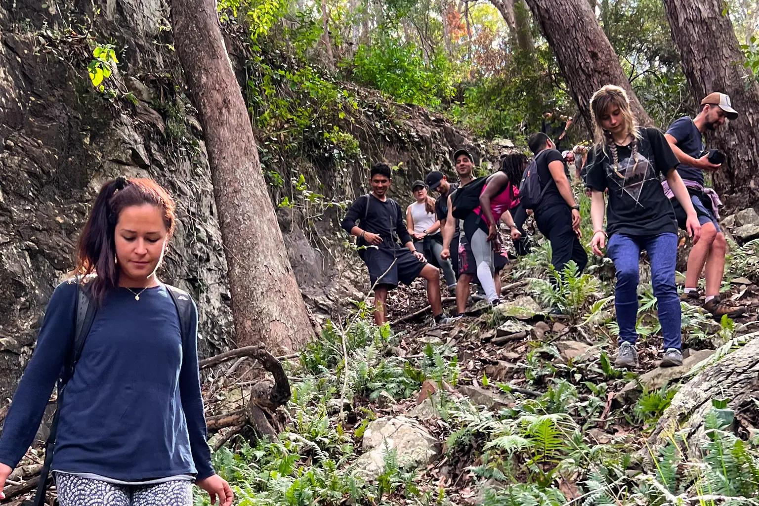
Seasoned hikers seeking an adventurous full-body workout should look no further than the Mount Greville Loop via the Waterfall Gorge and Palm Gorge in Queensland's picturesque Moogerah Peaks National Park. As one of the region's most challenging peak ascents, this grueling 5km circuit demands a very high level of fitness, scrambling ability, and navigational skills.
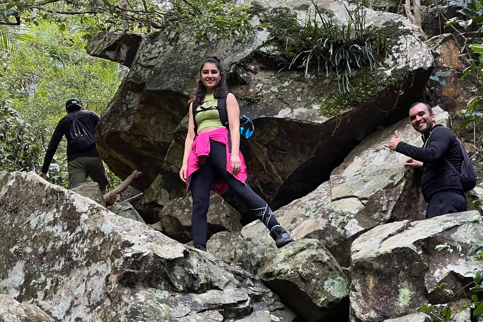
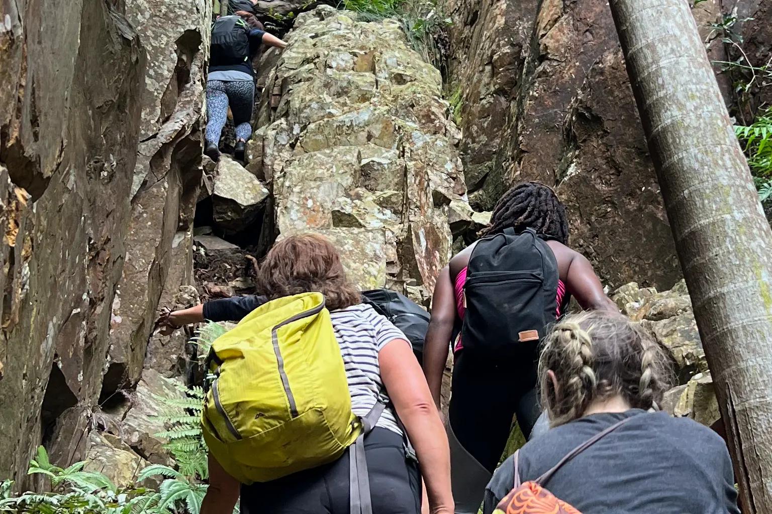
Use all four limbs to conquer the rocky creek bed of Waterfall Gorge, carefully climbing over boulders and squeezing through narrow corners surrounded by towering cliffs
Trail Talk: A Breakdown of the Hike
Wild life
Keep your eyes peeled for diverse wildlife
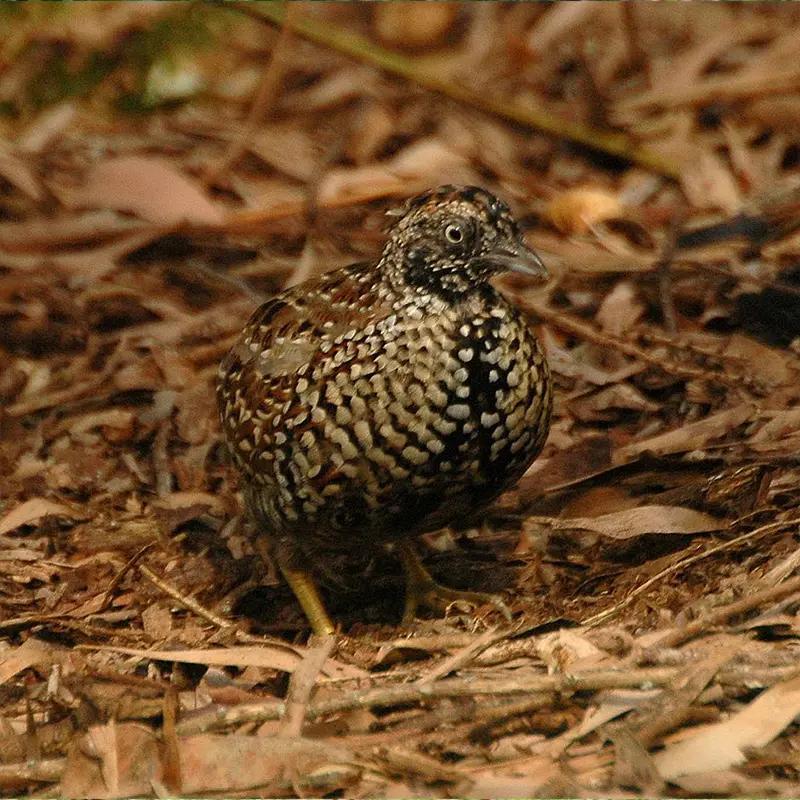
Brush-tailed rock-wallaby
The brush-tailed rock-wallaby (Petrogale penicillata) is a type of wallaby found in rock formations along the Great Dividing Range, approximately 100 km northwest of Brisbane.
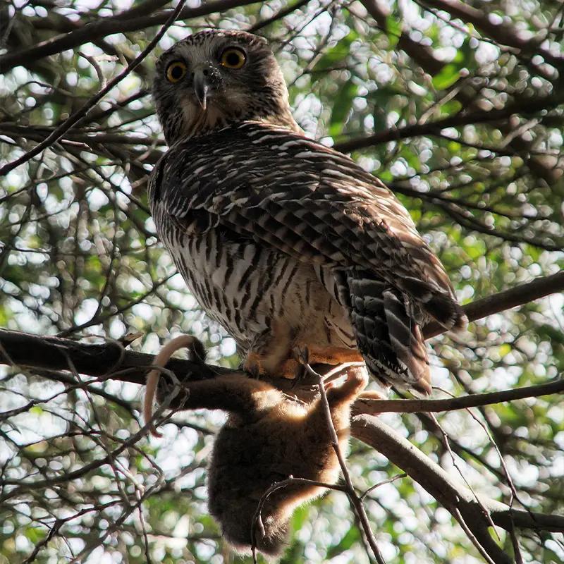
The Powerful owl
The powerful owl (Ninox strenua) is Australia's largest owl, found in coastal areas and the Great Dividing Range, typically within 200 km of the coast.

brush-tailed rock-wallaby
The brush-tailed rock-wallaby (Petrogale penicillata) inhabits rocky areas along the Great Dividing Range. Populations have declined significantly, with 70% of its habitat lost after 2020 bushfires.
Comparison with famous Queensland's most challengin summits

Pro Tip:
Download offline maps.
This unmarked trail demands reliable navigation. I use the AllTrails app for this.
Hiking Tips and Checklists:
Before You Lace Up!
Here are some key recommendations to enhance your Mount Greville Hike experience:
- Start Early: Thoroughly understand the physical demands, potential risks, and weather conditions, a Mt Greville Trail Map would come in handy.
- Hydrate, Hydrate, Hydrate! Bring plenty of water & fuel up with high-energy snacks
- Dress for Success: Wear sturdy hiking boots with good ankle support and breathable clothing.
- Choose the right path: Take Waterfall Gorge up to avoid impassable downclimb obstacles
- Leave No Trace: Pack out all your trash and respect the natural environment.
- Mind the Weather: Avoid hiking after heavy rain due to potential flash floods and slippery rocks.
Pack Checklist:
- Water bottles or hydration pack
- Food/snacks for the day
- First-aid kit
- Hiking Boots or Sturdy Shoes
- Sunscreen
- Mount Greville Trail map: Alltrails map
- Extra clothing layers (depending on weather conditions)
Pro Tip:
Study the trail map closely: It's easy to get turned around in the gorges and lose the route, even with a GPS app. Knowing how to take bearings from terrain features can prevent you from going in circles.
Mount Greville Route and Trail Notes
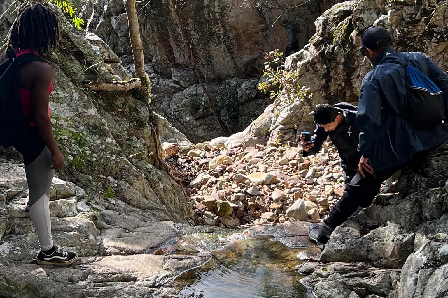
From parking to summit: The circuit starts from the Mt Greville carpark - follow the service road 200m to the signed Waterfall Gorge trail on the right. Descend into the gorge and scramble upstream, using hands and feet to climb over rocks, boulders, and through vegetated bottlenecks in the creek bed.
At the top, take the right fork to reach the viewpoint at Slab Rock's sloping rock slabs offering panoramic vistas of Lake Moogerah. Continue uphill from here through forest to the Mt Greville summit cairn.
For the descent, backtrack to the junction and take the left fork into Palm Gorge. Carefully pick your way down mossy boulder fields, maneuvering over fallen trees, roots, and through thick vegetation. At the bottom, hike downstream to reconnect with Waterfall Gorge's start point.
Stay Nearby
Extend your adventure by booking a night at Lake Moogerah. The Moogerah Lake Caravan Park offers camping sites right on the shores of the lake, just a short drive from the Mt Greville trailhead.
Lake Moogerah Camping is situated right on the shores of Lake Moogerah
FAQs:
How difficult is hiking up Waterfall Gorge?
As the most difficult ascent route, Waterfall Gorge requires Class 3 scrambling using your hands and feet to climb over boulders, logs, and through narrow rocky sections with exposure to cliffs on either side. Excellent route-finding skills are also a must.
Can I hike Mt Greville solo?
While some experienced scramblers may attempt it solo, the majority of hikers agree having a buddy is highly advisable give the trail's difficulty, navigation challenges, and potential obstacles.
Are there any exposed/high-risk areas?
While the actual gorges are relatively unexposed, some of the ridgeline sections near the summit traverse close to cliffs with exposure that demands extra caution.
What's the best footwear?
Sturdy hiking boots with excellent ankle support and deep, grippy tread are an absolute must for tackling the rough terrain and countless rocky sections.
What's the best season for this hike?
Spring and fall offer the most comfortable temperatures. Summer can be oppressively hot and humid in the gorges with higher risk of storms.
Can I bring my dog on the hike?
No, dogs are strictly not permitted on the Mt Greville trail or any trails within Moogerah Peaks National Park.
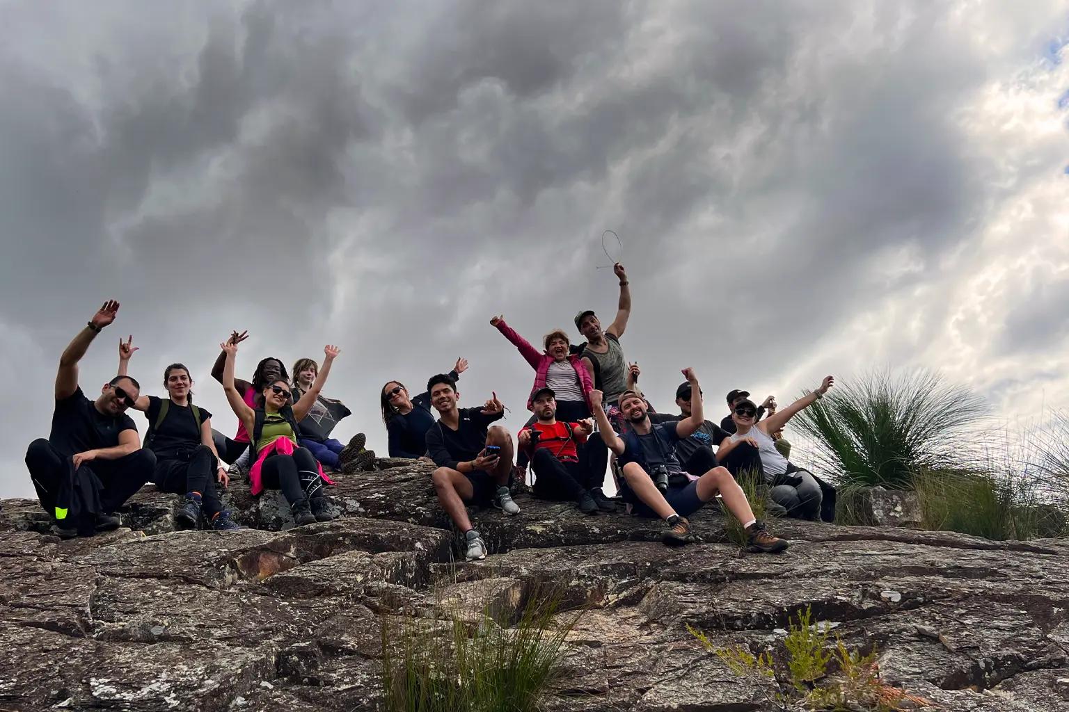
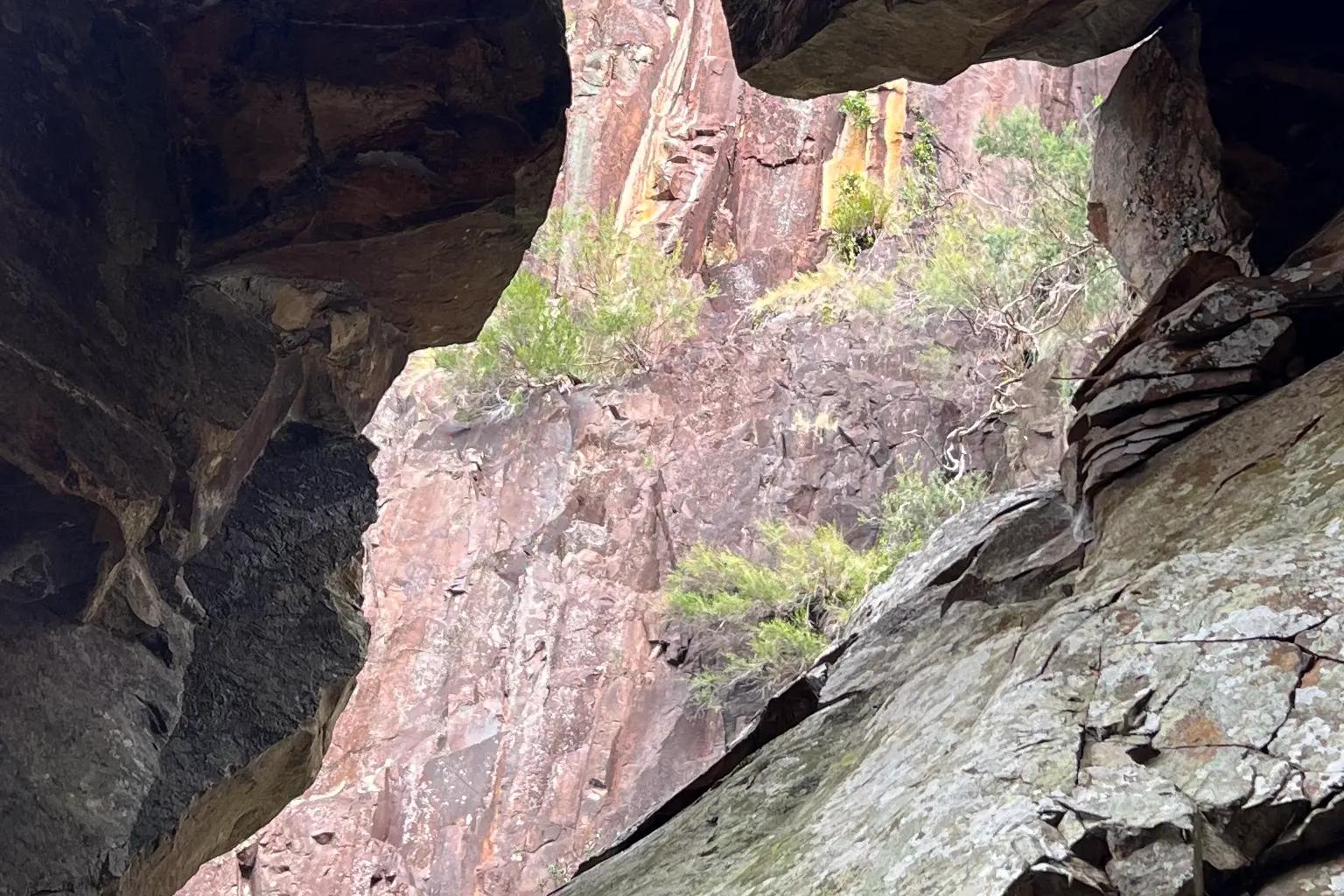
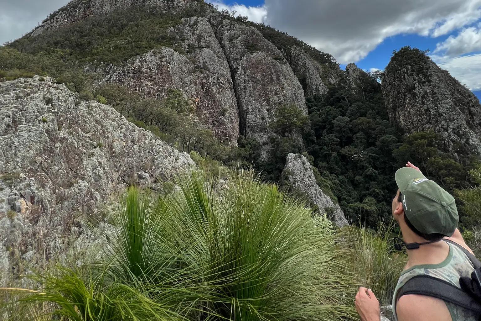
Gallery