Hike Mount May in the Scenic Rim - via Waterfall creek


Discover panoramic views and challenging trails in this hidden gem of Mount Barney National Park
Mount May | A Scenic Adventure in Queensland
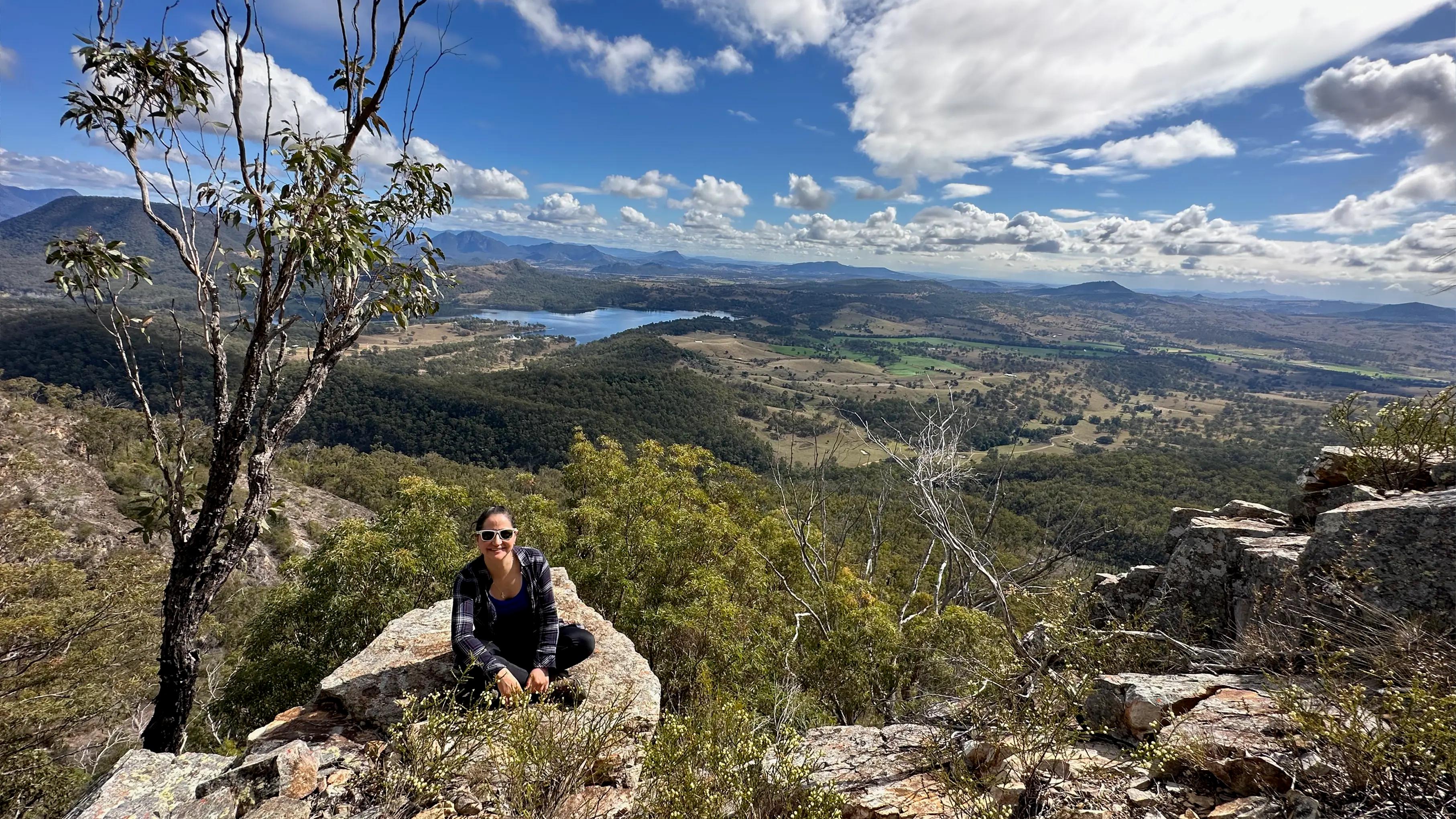
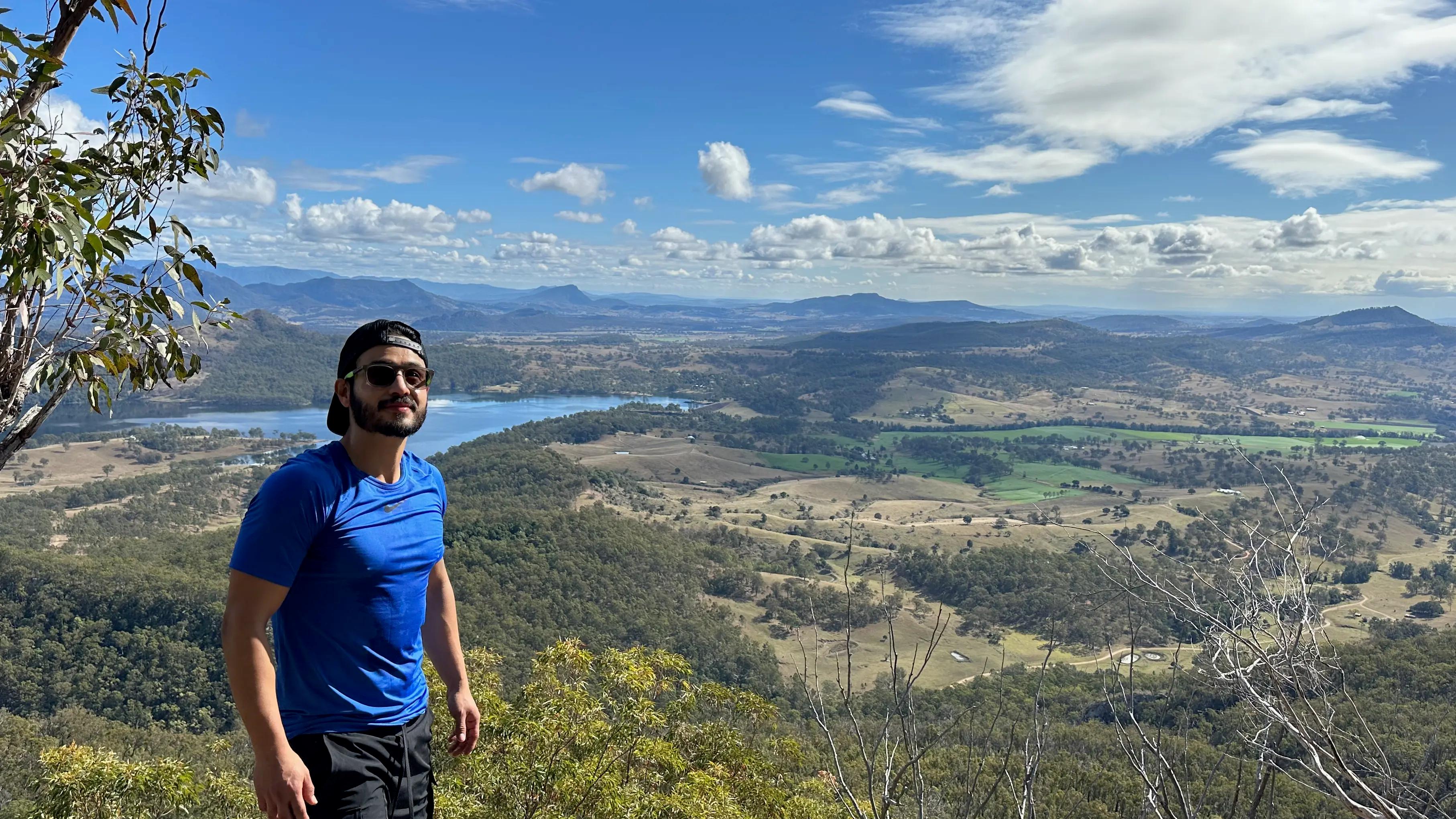
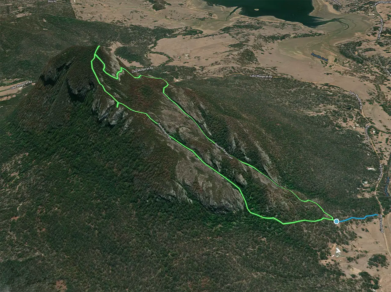
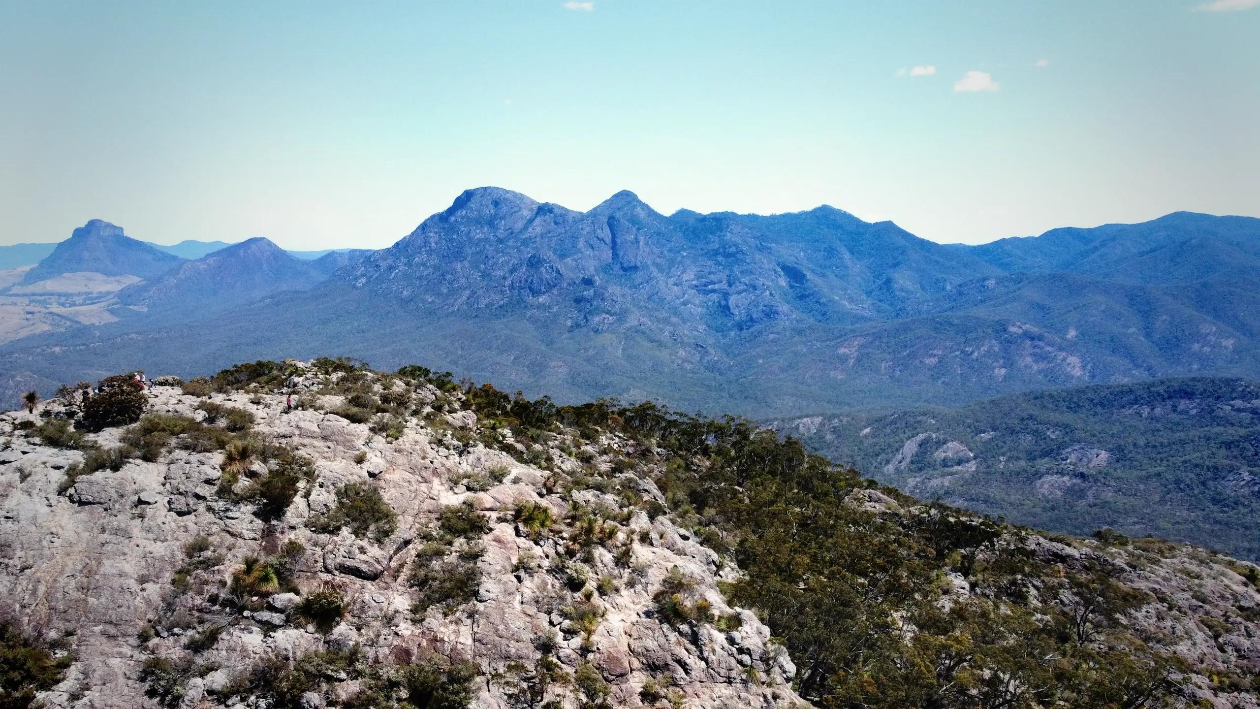
Mount May offers an exhilarating 6.6km loop trail that rewards hikers with stunning views of the Scenic Rim. This challenging route takes you through diverse terrain, from lush forests to rocky outcrops, culminating in breathtaking panoramas of Mount Barney and Lake Maroon.
Witness awe-inspiring vistas, and test your hiking skills on this hidden gem in Mount Barney National Park.
Trail Talk: A Breakdown of the Hike
Wild life
Keep your eyes peeled for diverse wildlife
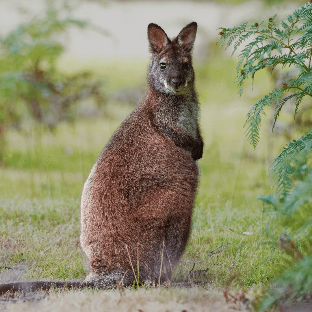
Red Necked Wallabi
A medium-sized macropod marsupial
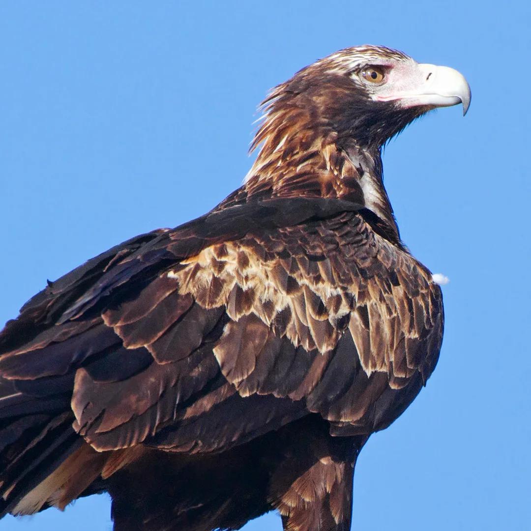
Wedge-tailed eagle
Commonly found in Mount Barney National Park
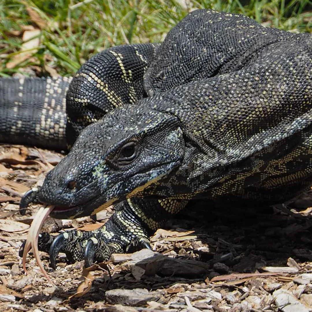
Lace Monitor
Also known as the tree goanna
Bare Rock Track and Morgans Walk Route and Trail Notes
Bare Rock Track and Morgans Walk Route and Trail Notes
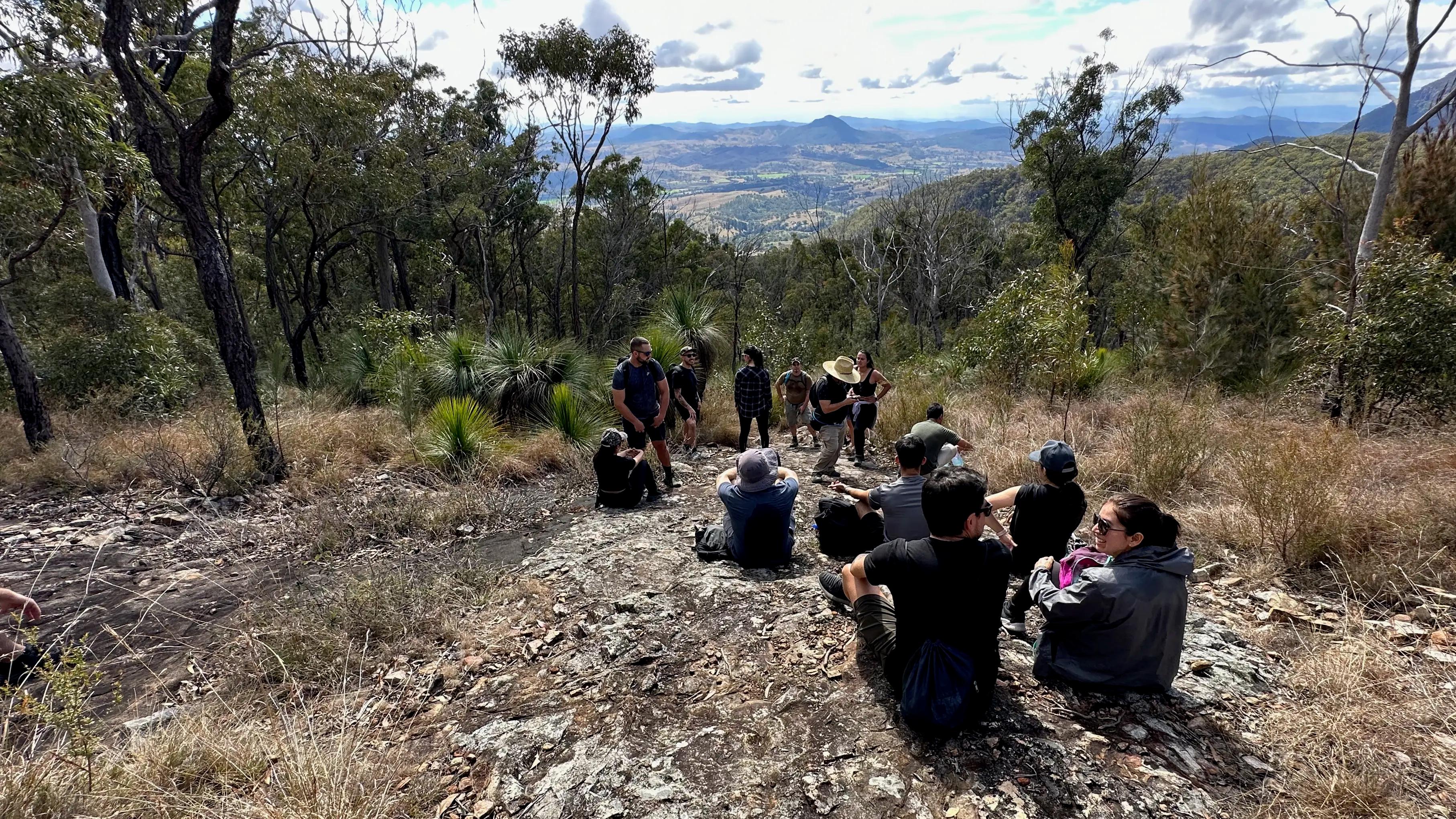
The trail begins with a steady incline through dense rainforest. After about 3km, you'll reach Mount Cordeaux summit. Continue to Bare Rock for more spectacular views. On the return journey, consider exploring Morgans Walk, a 700m side track leading to a beautiful montane heath grove. Be cautious of slippery conditions after rain and watch for Gympie-Gympie plants near the trail. Parking is available at the trailhead, along with toilets and water (treat before drinking).
Pro Tip:
Muscles refresh! After your hike, cool off in the swimming hole near the campground a perfect way to refresh tired muscles!
Comparison with famous Queensland's most challengin summits

Pro Tip:
Start early to catch the sunrise from the North Peak – the golden light illuminating Lake Maroon is a sight you won't forget!
Hiking Tips and Checklists:
Before You Lace Up!
Here are some key recommendations to enhance your Mount Greville Hike experience:
- Start Early: Thoroughly understand the physical demands, potential risks, and weather conditions, a Mt Greville Trail Map would come in handy.
- Hydrate, Hydrate, Hydrate! Bring plenty of water & fuel up with high-energy snacks.
- Dress for Success: Wear sturdy hiking boots with good ankle support and breathable clothing.
- Choose the right path: Take Waterfall Gorge up to avoid impassable downclimb obstacles.
- Leave No Trace: Pack out all your trash and respect the natural environment.
- Mind the Weather: Avoid hiking after heavy rain due to potential flash floods and slippery rocks.
- Offline map: Download an offline map or bring a physical copy for navigation
Pack Checklist:
- Water bottles or hydration pack
- Food/snacks for the day
- First-aid kit
- Hiking Boots or Sturdy Shoes
- Sunscreen
- Mt may Trail map: Via Waterfall Creek Loop Alltrails map
- Extra clothing layers (depending on weather conditions)
Pro Tip:
Pack some extra layers the summit can be chilly, especially if you're waiting for sunrise!
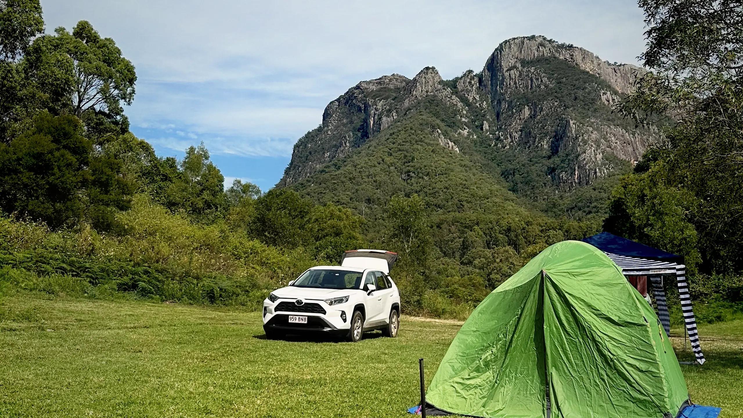
Stay Nearby
Consider camping at the nearby Goomburra section of Main Range National Park for a full immersion in nature. Alternatively, the town of Warwick, about 50km away, offers various accommodation options for those preferring more comfort after their hike.
Conclusion
The Bare Rock Track and Morgans Walk offer a challenging yet rewarding hiking experience in one of Queensland's most beautiful national parks. With its diverse ecosystems, stunning viewpoints, and rich wildlife, this trail provides the perfect blend of adventure and natural beauty. Whether you're a seasoned hiker or looking to push your limits, this hike promises an unforgettable journey through the heart of the Scenic Rim.
FAQs:
How long does Bare Rock and Morgan's track hike take?
On average, the hike takes 5-7 hours, depending on fitness level and time spent at viewpoints.
Can beginners attempt this hike?
While challenging, fit beginners can attempt this hike with proper preparation and allow for extra time.
Are there any dangerous animals to be aware of?
Be cautious of snakes, especially in warmer months. Make noise while walking to alert wildlife of your presence.
Is there mobile phone reception on the trail?
Reception can be limited in some areas. It's best to inform someone of your hiking plans before setting out.
What's the best time of year to hike Bare Rock Track?
The trail is beautiful year-round, but spring and autumn offer milder temperatures and clearer skies.
Are there any water sources along the trail?
While there's water available at the trailhead, it's best to bring enough for the entire hike as there are no reliable water sources along the trail.
Gallery